Cherry Cove Trail Loop Rough Creek Watershed
Cherry Cove Trail Loop Rough Creek Watershed : Distance: 7 miles Difficulty: Moderate
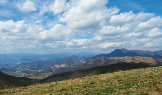
The seldom-used footpaths of the Rough Creek Watershed trail system in Haywood County cut through a wedge of conserved forestland with stellar views. Remnants of old home sites from the 1800s and apple orchards can also be seen throughout this 870-acre watershed. An ideal trek for exploring is this loop hike.
To reach the trailhead, hike the grassy path from the parking area. The trail climbs steeply above Rough Creek until taking a hard right. Follow the trail signs and meet a fence line in half a mile at a trio of oaks with a view of the Beaverdam Creek valley. Fork hard to the left, taking care to stay with the blue blazes. At 2.2 miles from the kiosk, look right for the Cherry Cove trailhead marker and follow the single-track trail uphill. At mile 3.3, reach the western boundary of the property on a high ridge. Stay on Cherry Cove Trail to reach the eastern boundary at mile 4.6. Head south on the grassy road returning to the trio of oaks at mile 5.7. Follow your tracks back to the kiosk to complete the 7-mile loop.
Navigate: From Asheville, take I-40 West to exit 33 and continue straight on Freedom Drive. At the junction, turn right on Beaverdam Road and in roughly two miles, left on Rice Cove Road. At the “T,” go right on Rough Water Road. In a quarter mile, go left through the closed gate and continue uphill to the parking area. Find a trail map at cantonnc.com/Rough-Creek-Watershed.